
Relaxin Retreat guidebook
Sightseeing
Terrapin Mountain Trail near Big Island, Virginia
Distance: 9.34 miles
Route Type: Loop
Terrapin Mountain Trail is a loop trail that takes you by a waterfall located near Big Island, Virginia.**
Little Rocky Row Loop via Appalachian Trail near Big Island, Virginia
Distance: 10.94 miles
Route Type: Loop
Little Rocky Row Loop via Appalachian Trail is a loop trail that takes you by a river located near Monroe, Virginia.**
Hike to Little and Big Rocky Row near Big Island, Virginia
Distance: 10.8 miles
Route Type: Out-and-Back
This hike along the Appalachian Trail leads to two beautiful rocky outcrops with stunning views of the James River. Big Rocky Row has similar views to Little Rocky Row but is worth the effort if you have time. Once finished exploring Big Rocky Row, head back south on the Appalachian Trail for 5.4 miles to return to your car.**
Otter Creek Loop near Big Island, Virginia
Length:1.0 mi
Route type: Loop
Explore this 1.00-mile, loop trail near Big Island, Virginia. This trail is great for hiking. **
James River Visitor Center and James River Trail of Trees
Length: 0.5 miles
Route type: Loop
This short 0.5-mile loop trail offers hikers river bottomland habitats, upland hardwood-hemlock forests, and several overlooks with views of the James River. This short self-guided tour can be productive for birders during spring and fall migration. **
Sharp Top Mountain Trailhead
Length: 3.3
Route type: Out-and-back
Located in the Jefferson National Forest in Virginia, Sharp Top is by far the most popular of the three Peaks of Otter, standing proud at 3,875 feet tall. The 360-degree views contribute to its popularity, but it helps that there are two ways to the top, a full out-and-back hike and a shuttle paired with a .25-mile hike.**
Flat Top Mountain Trailhead
Length: 4.7 0r 5.7 miles
Route type: Out-and-back
There are two ways to reach Flat Top, including a 4.7-mile out-and-back hike that originates near Abbott Lake (Abbott Lake route). There is also a 5.7-mile out-and-back hike that begins from a small parking area at milepost 83 on the Blue Ridge Parkway (Pinnacle route).**
Fallingwater Cascades Trail
Length: 1.2 miles
Route type: Out-and-Back
You never know what you’ll find around every curve of the iconic Blue Ridge Parkway. It could be a breathtaking overlook, a tumbling waterfall or an incredible hiking trail. At milepost 83 near Bedford, Virginia, we found the 1.2-mile out-and-back Fallingwater Cascades Trail. This trail shares a parking lot with the uber-popular hike to Flat Top.**
Peaks of Otter Hiking Trails
Sharp Top Trail
This is the most popular trail at the Peaks and originates at the Nature Center across the Parkway from the Visitor Center. This is a steep and strenuous route and should be attempted only by those in good health. There is no drinking water available on the summit, so carry plenty with you. The summit offers an impressive 360-degree view of the Peaks of Otter area, the Piedmont to the east, and the Shenandoah Valley with the Allegheny mountains to the west. Allow two hours for hiking up and one hour for hiking down. Add an extra half-hour for the spur trail to Buzzard’s Roost, a series of large rock formations offering different views of the area. Concession-operated bus service (one-way or round trip) to within one quarter mile of the top is available seasonally. Hiking along the bus road is prohibited.**
Elk Run Loop (0.8 mile)
Begins behind the visitor center. It is a moderately strenuous trail and is self-guiding with written displays describing the forest community. For a leisurely walk, allow one hour.**
Harkening Hill Loop Trail (3.3 miles)
Begins behind the visitor center and across from the amphitheater. This woodland trail climbs to a ridge where distant views are rewarding. A spur path near the summit leads to Balance Rock, an immense boulder balanced on a small rock.**
Johnson Farm Trails
A loop trail, approximately two miles long, which follows a section of the Harkening Hill loop trail. Beginning at the north end of the visitor center parking area, the trail leads 1.1 miles to the Johnson Farm, originally built in the 1850s. Like many mountain homes, this one was improved a number of times over the years. Living history demonstrations are presented on a seasonal basis. Allow two to three hours for a leisurely visit. (TRACK trail)**
Flat Top Trail
Was designated with Fallingwater Cascades trail as a continuous National Recreation Trail in April 1982. Flat Top rises to an elevation of 4,004 feet with many scattered rock outcrops. The Pinnacle and Cross Rock are names given to such formations. On this trail, hikers can experience the changing forest ecology as they climb or descend 1,600 feet from the Parkway trail heads. Fallingwater Cascades Trail the other segment of the National Recreation Trail, is a loop trail which takes hikers along cascades on Fallingwater Creek with its huge rock outcrops clothed in rhododendron and large hemlocks. This trail drops 260 feet below the Fallingwater Trail Parking Area and hikers should be prepared to climb that elevation on their return. Experiencing this mountain cascade is well worth the effort.**
Abbott Lake Trail
The least difficult of these trails, is a one-mile loop around Abbott Lake. The trail takes hikers through a woodland forest and open field, offering a close-up view of this picturesque lake. Trail is ADA Accessible. This is also a kid-friendly TRACK trail.**
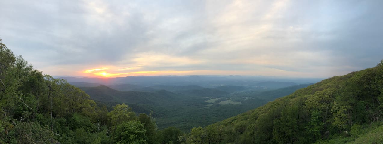
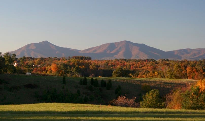
Blue Ridge Parkway
Blue Ridge ParkwayTerrapin Mountain Trail near Big Island, Virginia
Distance: 9.34 miles
Route Type: Loop
Terrapin Mountain Trail is a loop trail that takes you by a waterfall located near Big Island, Virginia.**
Little Rocky Row Loop via Appalachian Trail near Big Island, Virginia
Distance: 10.94 miles
Route Type: Loop
Little Rocky Row Loop via Appalachian Trail is a loop trail that takes you by a river located near Monroe, Virginia.**
Hike to Little and Big Rocky Row near Big Island, Virginia
Distance: 10.8 miles
Route Type: Out-and-Back
This hike along the Appalachian Trail leads to two beautiful rocky outcrops with stunning views of the James River. Big Rocky Row has similar views to Little Rocky Row but is worth the effort if you have time. Once finished exploring Big Rocky Row, head back south on the Appalachian Trail for 5.4 miles to return to your car.**
Otter Creek Loop near Big Island, Virginia
Length:1.0 mi
Route type: Loop
Explore this 1.00-mile, loop trail near Big Island, Virginia. This trail is great for hiking. **
James River Visitor Center and James River Trail of Trees
Length: 0.5 miles
Route type: Loop
This short 0.5-mile loop trail offers hikers river bottomland habitats, upland hardwood-hemlock forests, and several overlooks with views of the James River. This short self-guided tour can be productive for birders during spring and fall migration. **
Sharp Top Mountain Trailhead
Length: 3.3
Route type: Out-and-back
Located in the Jefferson National Forest in Virginia, Sharp Top is by far the most popular of the three Peaks of Otter, standing proud at 3,875 feet tall. The 360-degree views contribute to its popularity, but it helps that there are two ways to the top, a full out-and-back hike and a shuttle paired with a .25-mile hike.**
Flat Top Mountain Trailhead
Length: 4.7 0r 5.7 miles
Route type: Out-and-back
There are two ways to reach Flat Top, including a 4.7-mile out-and-back hike that originates near Abbott Lake (Abbott Lake route). There is also a 5.7-mile out-and-back hike that begins from a small parking area at milepost 83 on the Blue Ridge Parkway (Pinnacle route).**
Fallingwater Cascades Trail
Length: 1.2 miles
Route type: Out-and-Back
You never know what you’ll find around every curve of the iconic Blue Ridge Parkway. It could be a breathtaking overlook, a tumbling waterfall or an incredible hiking trail. At milepost 83 near Bedford, Virginia, we found the 1.2-mile out-and-back Fallingwater Cascades Trail. This trail shares a parking lot with the uber-popular hike to Flat Top.**
Peaks of Otter Hiking Trails
Sharp Top Trail
This is the most popular trail at the Peaks and originates at the Nature Center across the Parkway from the Visitor Center. This is a steep and strenuous route and should be attempted only by those in good health. There is no drinking water available on the summit, so carry plenty with you. The summit offers an impressive 360-degree view of the Peaks of Otter area, the Piedmont to the east, and the Shenandoah Valley with the Allegheny mountains to the west. Allow two hours for hiking up and one hour for hiking down. Add an extra half-hour for the spur trail to Buzzard’s Roost, a series of large rock formations offering different views of the area. Concession-operated bus service (one-way or round trip) to within one quarter mile of the top is available seasonally. Hiking along the bus road is prohibited.**
Elk Run Loop (0.8 mile)
Begins behind the visitor center. It is a moderately strenuous trail and is self-guiding with written displays describing the forest community. For a leisurely walk, allow one hour.**
Harkening Hill Loop Trail (3.3 miles)
Begins behind the visitor center and across from the amphitheater. This woodland trail climbs to a ridge where distant views are rewarding. A spur path near the summit leads to Balance Rock, an immense boulder balanced on a small rock.**
Johnson Farm Trails
A loop trail, approximately two miles long, which follows a section of the Harkening Hill loop trail. Beginning at the north end of the visitor center parking area, the trail leads 1.1 miles to the Johnson Farm, originally built in the 1850s. Like many mountain homes, this one was improved a number of times over the years. Living history demonstrations are presented on a seasonal basis. Allow two to three hours for a leisurely visit. (TRACK trail)**
Flat Top Trail
Was designated with Fallingwater Cascades trail as a continuous National Recreation Trail in April 1982. Flat Top rises to an elevation of 4,004 feet with many scattered rock outcrops. The Pinnacle and Cross Rock are names given to such formations. On this trail, hikers can experience the changing forest ecology as they climb or descend 1,600 feet from the Parkway trail heads. Fallingwater Cascades Trail the other segment of the National Recreation Trail, is a loop trail which takes hikers along cascades on Fallingwater Creek with its huge rock outcrops clothed in rhododendron and large hemlocks. This trail drops 260 feet below the Fallingwater Trail Parking Area and hikers should be prepared to climb that elevation on their return. Experiencing this mountain cascade is well worth the effort.**
Abbott Lake Trail
The least difficult of these trails, is a one-mile loop around Abbott Lake. The trail takes hikers through a woodland forest and open field, offering a close-up view of this picturesque lake. Trail is ADA Accessible. This is also a kid-friendly TRACK trail.**
A must visit for anyone interested in World War II or American military history.
119 lokalkjente anbefaler

National D-Day Memorial
3 Overlord CirA must visit for anyone interested in World War II or American military history.
Many great breweries, wineries, and cidery along Nelson 151 with awesome scenery!
https://www.nelson151.com/
7 lokalkjente anbefaler
Nelson County
Many great breweries, wineries, and cidery along Nelson 151 with awesome scenery!
https://www.nelson151.com/
Sedalia Center
1108 Sedalia School Roadwww.sedaliacenter.org
Bedford
https://www.roadtripsandcoffee.com/things-to-do-bedford-va
Explore Thomas Jefferson's personal retreat. Experience the natural beauty and architectural wonders of a National Historic Landmark.
www.poplarforest.org
90 lokalkjente anbefaler
Poplar Forest
1776 Bateman Bridge RdExplore Thomas Jefferson's personal retreat. Experience the natural beauty and architectural wonders of a National Historic Landmark.
www.poplarforest.org
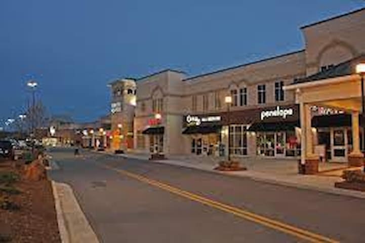
City/town information
Restaurants/Brewery/Bars in Downtown Lynchburg, VA
(~ 21 miles/36 minutes)
RA Bistro
Depot Grille*
My Dog Duke's Diner
Market At Main
Waterstone Pizza
Benny Scarpetta's
The Water Dog
El Jeffe
Texas Inn Downtown
Reserve Tasting Room & Lounge
Three Roads Brewing-Lynchburg
Starr Hill On Main
7 Rooftop Bar
Grocery stores in Lynchburg, VA
(~ 21 miles/36 minutes)
Fresh Market
Kroger
Food Lion
Walmart
38 lokalkjente anbefaler

Lynchburg
Restaurants/Brewery/Bars in Downtown Lynchburg, VA
(~ 21 miles/36 minutes)
RA Bistro
Depot Grille*
My Dog Duke's Diner
Market At Main
Waterstone Pizza
Benny Scarpetta's
The Water Dog
El Jeffe
Texas Inn Downtown
Reserve Tasting Room & Lounge
Three Roads Brewing-Lynchburg
Starr Hill On Main
7 Rooftop Bar
Grocery stores in Lynchburg, VA
(~ 21 miles/36 minutes)
Fresh Market
Kroger
Food Lion
Walmart
Restaurants/Brewery/Winery in Bedford, VA
(~ 19 miles/27 minutes)
Liberty Station
Fleming Mountain Grill *new* 13 miles/19 minutes
Bridge Street Cafe
Town Kitchen & Provisions
Clam Diggers
The Blue Lady
Beale’s (restaurant and brewery)
Leogrande Vineyards
Peaks of Otter Winery
Grocery stores in Bedford, VA
(~ 19 miles/27 minutes)
Food Lion
Walmart
25 lokalkjente anbefaler
Bedford
Restaurants/Brewery/Winery in Bedford, VA
(~ 19 miles/27 minutes)
Liberty Station
Fleming Mountain Grill *new* 13 miles/19 minutes
Bridge Street Cafe
Town Kitchen & Provisions
Clam Diggers
The Blue Lady
Beale’s (restaurant and brewery)
Leogrande Vineyards
Peaks of Otter Winery
Grocery stores in Bedford, VA
(~ 19 miles/27 minutes)
Food Lion
Walmart
Big Island, VA
(3.3 miles/7 minutes)
H&H Market (small grocery store and restaurant). Great place to have a country breakfast, lunch, or dinner.
New Restaurant: Fleming Mountain Grill (Dinner Monday-Saturday; Lunch/brunch/dinner on Sunday)
13 miles, 20 minutes from the cabin.

Big Island
Big Island, VA
(3.3 miles/7 minutes)
H&H Market (small grocery store and restaurant). Great place to have a country breakfast, lunch, or dinner.
New Restaurant: Fleming Mountain Grill (Dinner Monday-Saturday; Lunch/brunch/dinner on Sunday)
13 miles, 20 minutes from the cabin.
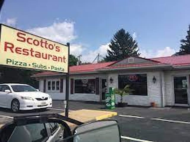
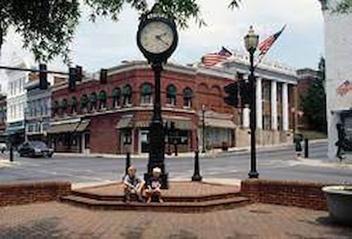
Glasgow
Restaurants Glasgow, VA
(14 miles/24 minutes)
Scotto’s Pizza
Restaurants/Brewery in Forest, VA
(~19 miles/33 minutes)
Benjamin’s Great Cows & Crabs
Bräuburgers Craft Burgers & Beer
V & T Cafe & Grill
Blue Ridge BBQ & Catering
Lori’s Italian Grill & Pizzeria
Mi Patron
The Backyard (food truck vendors)
The Neighbor's Place
The Crazy Mason Milkshake Bar
Apocalypse Ale Works & Beer Garden
Grocery Stores in Forest, VA
(~19 miles/33 minutes)*
Kroger
Food Lion
Walmart
Forest
Restaurants/Brewery in Forest, VA
(~19 miles/33 minutes)
Benjamin’s Great Cows & Crabs
Bräuburgers Craft Burgers & Beer
V & T Cafe & Grill
Blue Ridge BBQ & Catering
Lori’s Italian Grill & Pizzeria
Mi Patron
The Backyard (food truck vendors)
The Neighbor's Place
The Crazy Mason Milkshake Bar
Apocalypse Ale Works & Beer Garden
Grocery Stores in Forest, VA
(~19 miles/33 minutes)*
Kroger
Food Lion
Walmart
www.buenavistava
22 miles/35 minutes
Restaurants:
JJ's Meat Shack
Nick's Italian Kitchen
Don Tequila
Todd's Barbecue
Straws
Good Karma Food on the Move
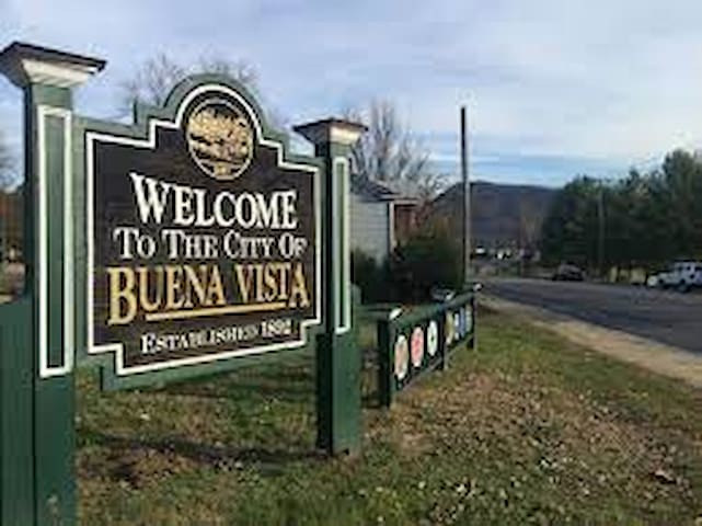
Buena Vista, Roanoke, VA 24013, USA
www.buenavistava
22 miles/35 minutes
Restaurants:
JJ's Meat Shack
Nick's Italian Kitchen
Don Tequila
Todd's Barbecue
Straws
Good Karma Food on the Move
Outdoor Adventure
Canoeing/tubing/kayak on the James River
James River Adventures
(21 miles/36 minutes)
www.jamesriveradventures.org
Wilderness Canoe Company
(19 miles/32 minutes)
wildernesscanoecompany.com
35 lokalkjente anbefaler

James River
Canoeing/tubing/kayak on the James River
James River Adventures
(21 miles/36 minutes)
www.jamesriveradventures.org
Wilderness Canoe Company
(19 miles/32 minutes)
wildernesscanoecompany.com
State park, caverns, zoo, and safari park:
Restaurants (Natural Bridge/Lexington Area):
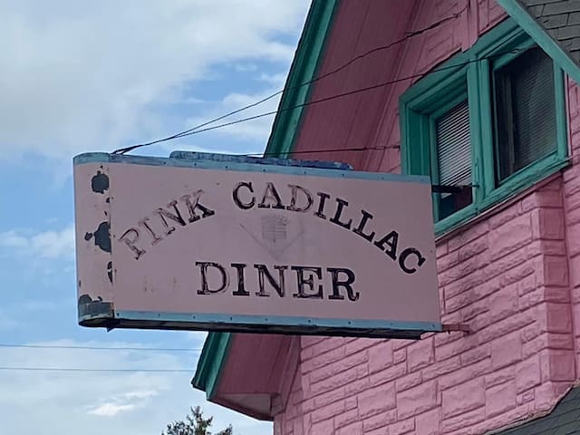
Pink Cadillac Diner
Bistro On Main
TAPS
Lexington Frank's Pizza and Subs
Globowl Cafe
110 lokalkjente anbefaler
Natural Bridge
State park, caverns, zoo, and safari park:
Restaurants (Natural Bridge/Lexington Area):
Pink Cadillac Diner
Bistro On Main
TAPS
Lexington Frank's Pizza and Subs
Globowl Cafe
Moneta, VA is the closest part of Smith Mountain Lake to our cabin.
Smith Mountain Lake Park is on the north shore of Smith Mountain Lake in Bedford County.
https://www.dcr.virginia.gov/state-parks/smith-mountain-lake
91 lokalkjente anbefaler
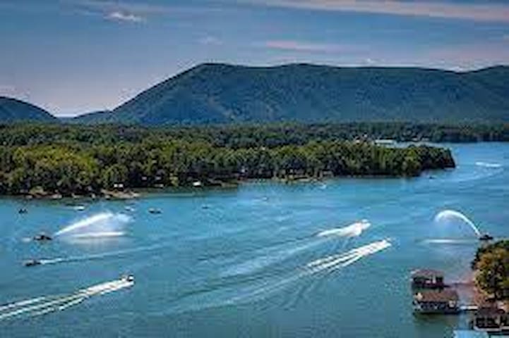
Smith Mountain Lake
Moneta, VA is the closest part of Smith Mountain Lake to our cabin.
Smith Mountain Lake Park is on the north shore of Smith Mountain Lake in Bedford County.
https://www.dcr.virginia.gov/state-parks/smith-mountain-lake
South Pedlar ATV Trail
Virginia 130www.virginia.org/listing/south-pedlar-atv-trails